
Böckweiler topographic map
Interactive map
Click on the map to display elevation.
About this map
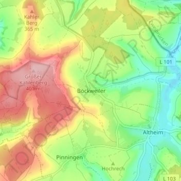
Name: Böckweiler topographic map, elevation, terrain.
Location: Böckweiler, Saarpfalz-Kreis, Saarland, Deutschland (49.16205 7.27270 49.20205 7.31270)
Average elevation: 1,040 ft
Minimum elevation: 784 ft
Maximum elevation: 1,342 ft