
蜈蚣山底 topographic map
Interactive map
Click on the map to display elevation.
About this map
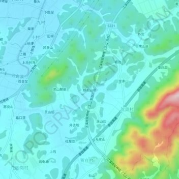
Name: 蜈蚣山底 topographic map, elevation, terrain.
Location: 蜈蚣山底, 清湖街道, 江山市, 衢州市, 浙江省, 中国 (28.62147 118.58120 28.66147 118.62120)
Average elevation: 509 ft
Minimum elevation: 331 ft
Maximum elevation: 1,375 ft