
Golightly topographic map
Click on the map to display elevation.
About this map
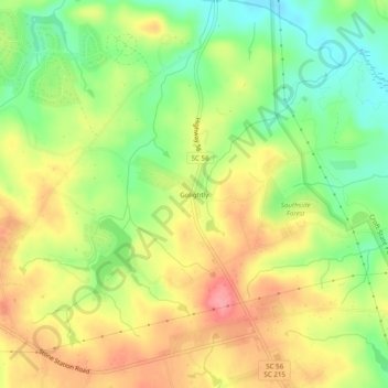
Name: Golightly topographic map, elevation, terrain.
Location: Golightly, Spartanburg County, South Carolina, United States (34.83735 -81.90538 34.87735 -81.86538)
Average elevation: 719 ft
Minimum elevation: 571 ft
Maximum elevation: 866 ft
Spartanburg County trails, hiking, mountain biking, running and outdoor activities
Other topographic maps
Click on a map to view its topography, its elevation and its terrain.
Lyman Lake
United States > South Carolina > Spartanburg County > Cove Subdivision
Average elevation: 912 ft