
Anapia topographic map
Interactive map
Click on the map to display elevation.
About this map
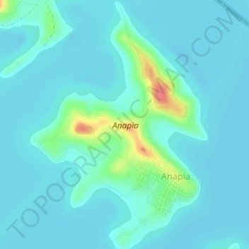
Name: Anapia topographic map, elevation, terrain.
Location: Anapia, Provincia de Yunguyo, Perú (-16.32250 -68.87080 -16.29302 -68.84882)
Average elevation: 12,533 ft
Minimum elevation: 12,497 ft
Maximum elevation: 12,743 ft