
Bassum topographic map
Interactive map
Click on the map to display elevation.
About this map
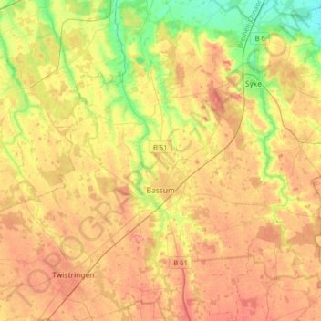
Name: Bassum topographic map, elevation, terrain.
Location: Bassum, Landkreis Diepholz, Nedersaksen, 27211, Duitsland (52.77128 8.62768 52.96234 8.88837)
Average elevation: 141 ft
Minimum elevation: 26 ft
Maximum elevation: 236 ft