
Estrasburgo topographic map
Interactive map
Click on the map to display elevation.
About this map
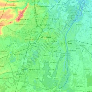
Name: Estrasburgo topographic map, elevation, terrain.
Location: Estrasburgo, Bajo-Rin, Gran Este, Francia metropolitana, Francia (48.49186 7.68814 48.64619 7.83606)
Average elevation: 472 ft
Minimum elevation: 417 ft
Maximum elevation: 633 ft