Geolocate

Le Crot aux Chiens topographic map

Click on the map to display elevation.

About this map

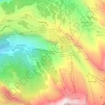
Name: Le Crot aux Chiens topographic map, elevation, terrain.

Location: Le Crot aux Chiens, Avoriaz, Morzine, Thonon-les-Bains, Upper Savoy, Auvergne-Rhône-Alpes, Metropolitan France, 74110, France (46.16748 6.74924 46.20748 6.78924)

Average elevation: 5,715 ft

Minimum elevation: 3,609 ft

Maximum elevation: 8,028 ft

Gear up for your next adventure:

🧭Pro Hiking Compasses - High-accuracy liquid-filled compasses for topographic orientation
🥾Men's Hiking Boots - Durable, waterproof footwear for rugged terrain and steep inclines
🛏️Cold Weather Sleeping Bag - Warm sleeping bag for cold conditions
🚪Portable Camp Chair - Foldable chair for comfort at camp
❄️Traction Cleats - Prevent slips on icy trails during winter hikes

As an Amazon Associate, this site earns from qualifying purchases at no extra cost to you.