
Sankt Stefan-Afiesl topographic map
Interactive map
Click on the map to display elevation.
About this map
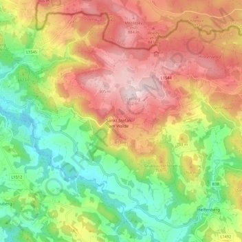
Name: Sankt Stefan-Afiesl topographic map, elevation, terrain.
Location: Sankt Stefan-Afiesl, Bezirk Rohrbach, Upper Austria, Austria (48.53893 14.06263 48.59776 14.16902)
Average elevation: 2,336 ft
Minimum elevation: 1,667 ft
Maximum elevation: 3,025 ft