
Painceiros topographic map
Interactive map
Click on the map to display elevation.
About this map
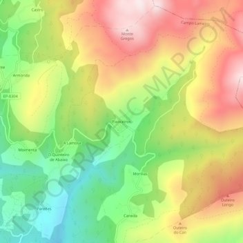
Name: Painceiros topographic map, elevation, terrain.
Average elevation: 1,490 ft
Minimum elevation: 531 ft
Maximum elevation: 2,516 ft
Other topographic maps
Click on a map to view its topography, its elevation and its terrain.
Caneda
Espagne > Galice > Pontevedra > Campo Lameiro
Caneda, Morillas, Campo Lameiro, Pontevedra, Galice, 36121, Espagne
Average elevation: 1,175 ft