
Seebach topographic map
Interactive map
Click on the map to display elevation.
About this map
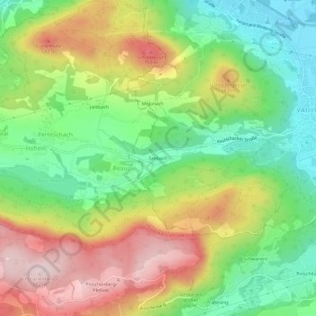
Name: Seebach topographic map, elevation, terrain.
Location: Seebach, Klagenfurt am Wörthersee, Kärnten, 9071, Österreich (46.56768 14.22201 46.60768 14.26201)
Average elevation: 1,946 ft
Minimum elevation: 1,427 ft
Maximum elevation: 2,621 ft
Other topographic maps
Click on a map to view its topography, its elevation and its terrain.
Annabichl
Österreich > Kärnten > Klagenfurt am Wörthersee
Annabichl, Klagenfurt am Wörthersee, Kärnten, 9026, Österreich
Average elevation: 1,588 ft
St. Ruprecht
Österreich > Kärnten > Klagenfurt am Wörthersee
St. Ruprecht, Klagenfurt am Wörthersee, Kärnten, Österreich
Average elevation: 1,483 ft