
Hoppegarten topographic map
Interactive map
Click on the map to display elevation.
About this map
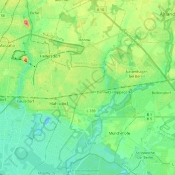
Name: Hoppegarten topographic map, elevation, terrain.
Location: Hoppegarten, Märkisch-Oderland, Brandebourg, Allemagne (52.46645 13.61059 52.56948 13.68877)
Average elevation: 171 ft
Minimum elevation: 98 ft
Maximum elevation: 341 ft
Other topographic maps
Click on a map to view its topography, its elevation and its terrain.
Beauregard
Allemagne > Brandebourg > Märkisch-Oderland > Wriezen
Beauregard, Altwriezen/Beauregard, Wriezen, Oderaue, Märkisch-Oderland, Brandebourg, Allemagne
Average elevation: 16 ft