
Penanggungan topographic map
Interactive map
Click on the map to display elevation.
About this map
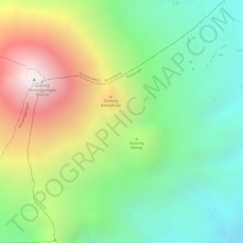
Name: Penanggungan topographic map, elevation, terrain.
Location: Penanggungan, Mojokerto, Jatim, Indonésie (-7.62005 112.62995 -7.61995 112.63005)
Average elevation: 2,995 ft
Minimum elevation: 1,345 ft
Maximum elevation: 5,377 ft