
Palmira topographic map
Interactive map
Click on the map to display elevation.
About this map
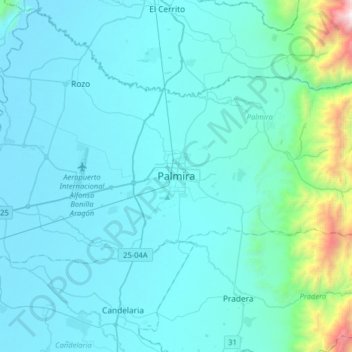
Name: Palmira topographic map, elevation, terrain.
Location: Palmira, Sur, Valle del Cauca, 76520, Colombia (3.37084 -76.45880 3.69084 -76.13880)
Average elevation: 3,868 ft
Minimum elevation: 3,081 ft
Maximum elevation: 11,814 ft