
O Sillabreu topographic map
Interactive map
Click on the map to display elevation.
About this map
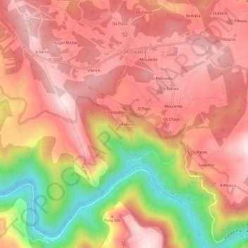
Name: O Sillabreu topographic map, elevation, terrain.
Location: O Sillabreu, A Capela, Eume, La Coruña, Galicia, 15613, España (43.40372 -8.09130 43.44372 -8.05130)
Average elevation: 1,004 ft
Minimum elevation: 72 ft
Maximum elevation: 1,503 ft