Geolocate

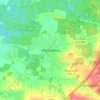
Teugn topographic map

Click on the map to display elevation.

About this map

Name: Teugn topographic map, elevation, terrain.

Location: Teugn, Saal an der Donau (VGem), Landkreis Kelheim, Bavaria, 93356, Germany (48.87200 11.96717 48.91127 12.04909)

Average elevation: 1,322 ft

Minimum elevation: 1,106 ft

Maximum elevation: 1,535 ft

Other topographic maps

Click on a map to view its topography, its elevation and its terrain.
Paring

Germany > Bavaria > Landkreis Kelheim

Average elevation: 1,325 ft

Offenstetten

Germany > Bavaria > Landkreis Kelheim

Average elevation: 1,263 ft

Buch

Germany > Bavaria > Landkreis Kelheim

Average elevation: 1,467 ft

Mauern

Germany > Bavaria > Landkreis Kelheim > Neustadt an der Donau

Average elevation: 1,158 ft

Neuenkehrsdorf

Germany > Bavaria > Landkreis Kelheim > Riedenburg

Average elevation: 1,450 ft

Gear up for your next adventure:

🪓Survival Multi‑Tool - Versatile tool for camp and trail tasks
🪑Ultralight Camp Chairs - Portable seating for resting after a long day of mapping
👖Convertible Hiking Pants - Versatile zip-off pants for changing altitudes and temperatures
🧣Hiking Neck Gaiter - Multi‑use neck protection for outdoor weather
🔥Camping Stove - Portable stove for camping and backcountry cooking

As an Amazon Associate, this site earns from qualifying purchases at no extra cost to you.