
Shell topographic map
Interactive map
Click on the map to display elevation.
About this map
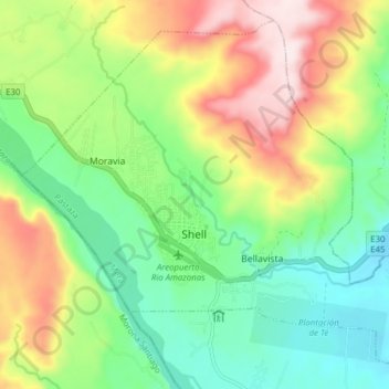
Name: Shell topographic map, elevation, terrain.
Location: Shell, Mera, Pastaza, Ecuador (-1.52686 -78.09597 -1.45744 -78.01855)
Average elevation: 3,609 ft
Minimum elevation: 3,012 ft
Maximum elevation: 4,587 ft