
光山县 topographic map
Interactive map
Click on the map to display elevation.
About this map
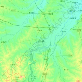
Name: 光山县 topographic map, elevation, terrain.
Location: 光山县, 紫水街道, 光山县, 信阳市, 河南省, 中国 (31.85318 114.73779 32.17318 115.05779)
Average elevation: 210 ft
Minimum elevation: 105 ft
Maximum elevation: 610 ft