
Jashla topographic map
Interactive map
Click on the map to display elevation.
About this map
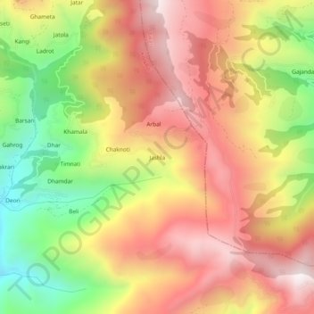
Name: Jashla topographic map, elevation, terrain.
Location: Jashla, Kotkhai, Shimla district, Himachal Pradesh, India (31.14489 77.57032 31.18489 77.61032)
Average elevation: 7,956 ft
Minimum elevation: 6,348 ft
Maximum elevation: 9,252 ft
Other topographic maps
Click on a map to view its topography, its elevation and its terrain.
Gumma
India > Himachal Pradesh > Kotkhai
Gumma, Kotkhai, Shimla, Himachal Pradesh, 171202, India
Average elevation: 5,928 ft
Devgarh
India > Himachal Pradesh > Kotkhai
Devgarh, Kotkhai, Shimla district, Himachal Pradesh, 171220, India
Average elevation: 6,316 ft