
Naraha topographic map
Interactive map
Click on the map to display elevation.
About this map
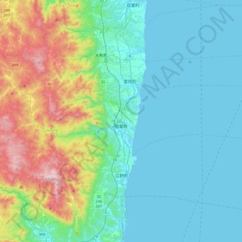
Name: Naraha topographic map, elevation, terrain.
Location: Naraha, Futaba County, Fukushima Prefecture, Japan (37.23911 140.86703 37.33954 141.28920)
Average elevation: 600 ft
Minimum elevation: 0 ft
Maximum elevation: 2,782 ft
Other topographic maps
Click on a map to view its topography, its elevation and its terrain.
みるーる天神
Japan > Futaba County > Naraha
みるーる天神, 広野小高線旧道, Maebara, Naraha, Futaba County, Fukushima Prefecture, 979-0513, Japan
Average elevation: 30 ft
Kawauchi
Japan > Futaba County > Kawauchi
Kawauchi, Futaba County, Fukushima Prefecture, Japan
Average elevation: 1,883 ft
Okuma
Okuma, Futaba County, Fukushima Prefecture, Japan
Average elevation: 735 ft