Geolocate

Olmos topographic map

Click on the map to display elevation.

About this map

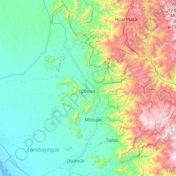
Name: Olmos topographic map, elevation, terrain.

Location: Olmos, Province of Lambayeque, Lambayeque, Peru (-6.45895 -80.62713 -5.48039 -79.59296)

Average elevation: 2,877 ft

Minimum elevation: -10 ft

Maximum elevation: 13,442 ft

Gear up for your next adventure:

🛏️Cold Weather Sleeping Bag - Warm sleeping bag for cold conditions
🖼️Topo Map Wall Art - Decorative topographic prints of famous peaks and regions
🎒Trekking Poles - Sturdy poles for balance and stability on rough terrain
📱Solar Portable Charger - Solar power bank for charging devices off‑grid
🍳Camping Cook Set - Complete cookware for outdoor meals

As an Amazon Associate, this site earns from qualifying purchases at no extra cost to you.