Geolocate

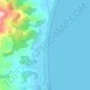
Preston topographic map

Click on the map to display elevation.

About this map

Name: Preston topographic map, elevation, terrain.

Location: Preston, Central Coast, Tasmania, 7315, Australia (-41.33851 146.00665 -41.24956 146.11501)

Average elevation: 1,001 ft

Minimum elevation: 138 ft

Maximum elevation: 1,906 ft

Other topographic maps

Click on a map to view its topography, its elevation and its terrain.
The Nut

Australia > Tasmania > Stanley

Average elevation: 26 ft

Cathedral Mountain

Australia > Tasmania

Average elevation: 3,255 ft

Rowlands Hill

Australia > Tasmania

Average elevation: 1,273 ft

Waterworks Reserve

Australia > Tasmania > Hobart

Average elevation: 787 ft

Cradle Mountain

Australia > Tasmania > Cradle Mountain

Average elevation: 3,753 ft

Bream Creek

Australia > Tasmania > Bream Creek

Average elevation: 115 ft

West Gawler River

Australia > Tasmania > Sprent > Gawler

Average elevation: 659 ft

Gear up for your next adventure:

🏥Hiking First Aid Kits - Comprehensive medical kits for remote trail injuries
🛡️Insect Repellent - Protection against bugs during outdoor activities
🪶LED Camping Lantern - Bright lantern for camp lighting
🦟Ultrasonic Repellers - Create a bug-free zone at your camp or rest stop
🪄Magnetic Compass - Accurate compass for navigation

As an Amazon Associate, this site earns from qualifying purchases at no extra cost to you.