
Cairo Montenotte topographic map
Interactive map
Click on the map to display elevation.
About this map
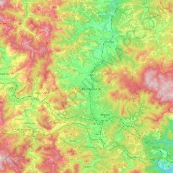
Name: Cairo Montenotte topographic map, elevation, terrain.
Location: Cairo Montenotte, Savona, Liguria, Italy (44.34679 8.20775 44.45589 8.43183)
Average elevation: 1,608 ft
Minimum elevation: 600 ft
Maximum elevation: 2,795 ft
Other topographic maps
Click on a map to view its topography, its elevation and its terrain.
Fontanassa
Italy > Liguria > Savona > Savona
Fontanassa, La Rocca, Savona, Liguria, 17100, Italy
Average elevation: 276 ft
Celle Ligure
Celle Ligure, Savona, Liguria, 17015, Italy
Average elevation: 394 ft
Bardino Nuovo
Bardino Nuovo, Tovo San Giacomo, Savona, Liguria, 17027, Italy
Average elevation: 935 ft
Finale Ligure
Finale Ligure, Savona, Liguria, 17024, Italy
Average elevation: 535 ft