New Bern topographic map
Click on the map to display elevation.
New Bern
New Bern exhibits a predominantly flat terrain characterized by low-lying areas near its coastal rivers. The city is strategically positioned at the confluence of the Neuse and Trent rivers, where the elevation averages around 10 to 20 feet (3 to 6 meters) above sea level. This coastal setting contributes to a generally gentle slope towards the waterways, with many parts of the city experiencing elevations that are relatively uniform. The surrounding landscape features marshlands and wetlands, especially near the rivers and the headwaters of Pamlico Sound, which can be subject to seasonal flooding. As such, New Bern’s topography is reflective of its historical significance as a port city, playing a vital role in maritime navigation and trade throughout its history.
About this map
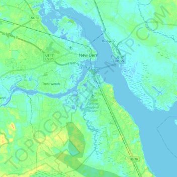
Name: New Bern topographic map, elevation, terrain.
Location: New Bern, Craven County, North Carolina, United States (34.99573 -77.15870 35.15945 -76.99148)
Average elevation: 16 ft
Minimum elevation: -30 ft
Maximum elevation: 69 ft
Craven County trails, hiking, mountain biking, running and outdoor activities
Other topographic maps
Click on a map to view its topography, its elevation and its terrain.