
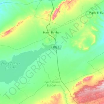
Hassi Bahbah topographic map
Interactive map
Click on the map to display elevation.
About this map
Name: Hassi Bahbah topographic map, elevation, terrain.
Location: Hassi Bahbah, Daïra Hassi Bahbah, Djelfa, Algérie (34.85238 2.67865 35.14017 3.18207)
Average elevation: 2,972 ft
Minimum elevation: 2,625 ft
Maximum elevation: 4,285 ft
Other topographic maps
Click on a map to view its topography, its elevation and its terrain.
Zaafrane
Algérie > Djelfa > Daïra Hassi Bahbah
Zaafrane, Daïra Hassi Bahbah, Djelfa, Algérie
Average elevation: 3,222 ft
Aïn Maabed
Algérie > Djelfa > Daïra Hassi Bahbah > Aïn Maabed
Aïn Maabed, Daïra Hassi Bahbah, Djelfa, Algérie
Average elevation: 3,301 ft