
Muna topographic map
Interactive map
Click on the map to display elevation.
About this map
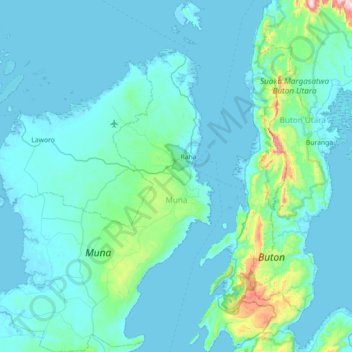
Name: Muna topographic map, elevation, terrain.
Location: Muna, Célebes Sudoriental, Célebes, Indonesia (-5.22786 122.26866 -4.51453 122.92798)
Average elevation: 220 ft
Minimum elevation: -3 ft
Maximum elevation: 2,956 ft