
Refuge de Bassiès topographic map
Interactive map
Click on the map to display elevation.
About this map
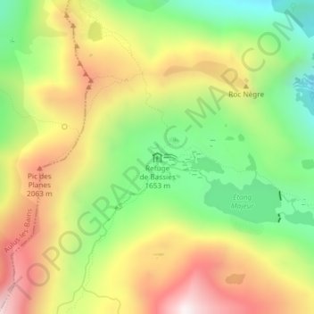
Name: Refuge de Bassiès topographic map, elevation, terrain.
Average elevation: 5,968 ft
Minimum elevation: 4,675 ft
Maximum elevation: 7,431 ft
Other topographic maps
Click on a map to view its topography, its elevation and its terrain.
Casiérens
France > Occitanie > Ariège > Aulus-les-Bains
Casiérens, Aulus-les-Bains, Saint-Girons, Ariège, Occitanie, France métropolitaine, 09140, France
Average elevation: 5,810 ft