Geolocate

Bidholi topographic map

Click on the map to display elevation.

About this map

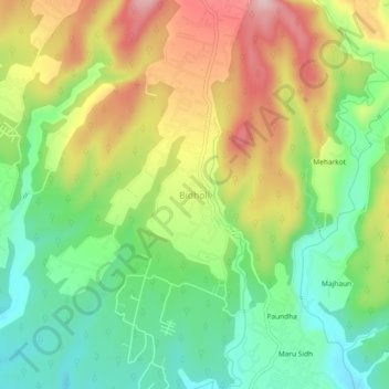
Name: Bidholi topographic map, elevation, terrain.

Location: Bidholi, Vikasnagar, Dehradun, Uttarakhand, 248007, India (30.37043 77.94750 30.41043 77.98750)

Average elevation: 2,415 ft

Minimum elevation: 2,080 ft

Maximum elevation: 2,861 ft

Gear up for your next adventure:

🥤Water Filter Bottle - All‑in‑one filter bottle for safe hydration
🧺Microfiber Travel Towels - Compact and fast-drying towels for trail use
🧥Waterproof Jacket for Hiking - Breathable and rugged rain jacket for outdoor excursions
🔌Solar Panel Charger - Charge gear sustainably outdoors
🔭Compact Binoculars - HD vision for scouting terrain and identifying distant landmarks

As an Amazon Associate, this site earns from qualifying purchases at no extra cost to you.