
Balsa de Charco Hondo topographic map
Interactive map
Click on the map to display elevation.
About this map
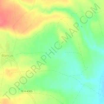
Name: Balsa de Charco Hondo topographic map, elevation, terrain.
Location: Balsa de Charco Hondo, Blancas, Jiloca, Teruel, Aragon, Spain (40.81471 -1.46649 40.81492 -1.46617)
Average elevation: 3,415 ft
Minimum elevation: 3,317 ft
Maximum elevation: 3,530 ft