
Hoamsan Mountain topographic map
Interactive map
Click on the map to display elevation.
About this map
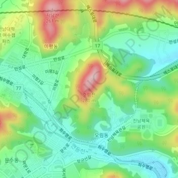
Name: Hoamsan Mountain topographic map, elevation, terrain.
Location: Hoamsan Mountain, Yeosu-si, South Jeolla, 59629, South Korea (34.76668 127.71443 34.76678 127.71453)
Average elevation: 325 ft
Minimum elevation: 52 ft
Maximum elevation: 827 ft
Other topographic maps
Click on a map to view its topography, its elevation and its terrain.
Sijeon-dong
South Korea > Yeosu-si > Sijeon-dong
Sijeon-dong, Yeosu-si, South Jeolla, 59683, South Korea
Average elevation: 262 ft
Orim-dong
South Korea > Yeosu-si > Orim-dong
Orim-dong, Yeosu-si, Jeollanam-do, 59697, South Korea
Average elevation: 351 ft