
Nicolás Bravo topographic map
Interactive map
Click on the map to display elevation.
About this map
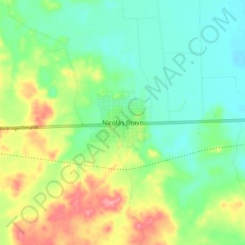
Name: Nicolás Bravo topographic map, elevation, terrain.
Location: Nicolás Bravo, Othón P. Blanco, Quintana Roo, México (18.41946 -88.96805 18.49946 -88.88805)
Average elevation: 344 ft
Minimum elevation: 240 ft
Maximum elevation: 538 ft
Other topographic maps
Click on a map to view its topography, its elevation and its terrain.
Chetumal
México > Quintana Roo > Othón P. Blanco
Chetumal, Othón P. Blanco, Quintana Roo, México
Average elevation: 20 ft