Geolocate

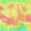
District 9 topographic map

Click on the map to display elevation.

About this map

Name: District 9 topographic map, elevation, terrain.

Location: District 9, Baguio, Cordillera Administrative Region, 2600, Philippines (16.42354 120.59921 16.43114 120.61015)

Average elevation: 4,774 ft

Minimum elevation: 4,354 ft

Maximum elevation: 5,344 ft

Other topographic maps

Click on a map to view its topography, its elevation and its terrain.
SLU-SVP Housing Village

Philippines > Baguio

Average elevation: 4,521 ft

Burnham Park

Philippines > Baguio > Harrison-Claudio-Carantes

Average elevation: 4,741 ft

Panagbenga Park

Philippines > Baguio > South Drive

Average elevation: 4,731 ft

Happy Homes

Philippines > Baguio

Average elevation: 4,741 ft

Kagitingan

Philippines > Baguio

Average elevation: 4,783 ft

Poblacion

Philippines > Baguio

Average elevation: 4,239 ft

DPS Compound

Philippines > Baguio > DPS Compound

Average elevation: 4,682 ft

Ambiong

Philippines > Baguio > Ambiong

Average elevation: 4,862 ft

Harrison-Claudio-Carantes

Philippines > Baguio

Average elevation: 4,744 ft

South Drive

Philippines > Baguio

Average elevation: 4,682 ft

Gear up for your next adventure:

🔋Rechargeable Batteries - Power up your outdoor devices
🪶Multi‑Purpose Knife - Useful blade for camp and trail
🚗GPS Dash Cams - Record your scenic drives through mountain passes and canyons
🦺Reflective Outdoor Gear - Safety gear for low‑light conditions
🥘Titanium Cookware - Durable, featherlight pots and pans for backpacking

As an Amazon Associate, this site earns from qualifying purchases at no extra cost to you.