
Hotham Village topographic map
Interactive map
Click on the map to display elevation.
About this map
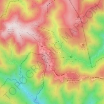
Name: Hotham Village topographic map, elevation, terrain.
Average elevation: 5,200 ft
Minimum elevation: 3,927 ft
Maximum elevation: 6,112 ft
Other topographic maps
Click on a map to view its topography, its elevation and its terrain.
Mount Hotham
Australia > Victoria > Mount Hotham Alpine Resort
Mount Hotham, Mount Hotham Alpine Resort, Victoria, Australia
Average elevation: 5,364 ft