
Dąbrowa Białostocka topographic map
Interactive map
Click on the map to display elevation.
About this map
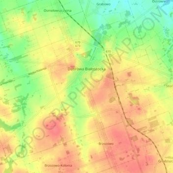
Name: Dąbrowa Białostocka topographic map, elevation, terrain.
Average elevation: 502 ft
Minimum elevation: 394 ft
Maximum elevation: 584 ft
Other topographic maps
Click on a map to view its topography, its elevation and its terrain.
Majewo
Poland > Podlaskie Voivodeship > Sokółka County
Majewo, gmina Sidra, Sokółka County, Podlaskie Voivodeship, Poland
Average elevation: 591 ft
Krynki
Poland > Podlaskie Voivodeship > Sokółka County
Krynki, gmina Krynki, Sokółka County, Podlaskie Voivodeship, Poland
Average elevation: 545 ft
Jelenia Góra
Poland > Podlaskie Voivodeship > Sokółka County
Jelenia Góra, gmina Sokółka, Sokółka County, Podlaskie Voivodeship, Poland
Average elevation: 545 ft