
Ciudad López Mateos topographic map
Interactive map
Click on the map to display elevation.
About this map
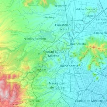
Name: Ciudad López Mateos topographic map, elevation, terrain.
Average elevation: 7,959 ft
Minimum elevation: 7,290 ft
Maximum elevation: 11,529 ft
Its main elevations are Biznaga Hill, Atlaco Hill La Condesa Hill and Grande Hill.