
Verwall Alps topographic map
Interactive map
Click on the map to display elevation.
About this map
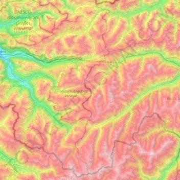
Name: Verwall Alps topographic map, elevation, terrain.
Location: Verwall Alps, Silbertal, Bludenz, Vorarlberg, Austria (46.96344 9.83689 47.15129 10.49187)
Average elevation: 6,421 ft
Minimum elevation: 1,860 ft
Maximum elevation: 11,109 ft