
Tambubong topographic map
Interactive map
Click on the map to display elevation.
About this map
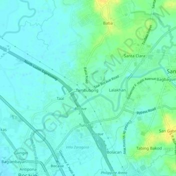
Name: Tambubong topographic map, elevation, terrain.
Location: Tambubong, Bulacan, Central Luzon, 3014, Philippines (14.79535 120.91957 14.83535 120.95957)
Average elevation: 26 ft
Minimum elevation: 7 ft
Maximum elevation: 79 ft
Other topographic maps
Click on a map to view its topography, its elevation and its terrain.
Tumana Park
Philippines > Bulacan > Tambubong
Tumana Park, Tambubong, Bulacan, Central Luzon, Philippines
Average elevation: 26 ft