
Vilela topographic map
Interactive map
Click on the map to display elevation.
About this map
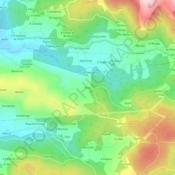
Name: Vilela topographic map, elevation, terrain.
Location: Vilela, Cerdido, Ortegal, La Coruña, Galicia, 15530, España (43.61350 -7.98370 43.65350 -7.94370)
Average elevation: 787 ft
Minimum elevation: 341 ft
Maximum elevation: 1,588 ft