
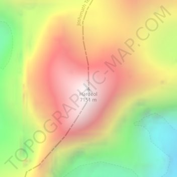
Hardeol topographic map
Interactive map
Click on the map to display elevation.
About this map
Name: Hardeol topographic map, elevation, terrain.
Average elevation: 20,433 ft
Minimum elevation: 17,175 ft
Maximum elevation: 23,330 ft
Other topographic maps
Click on a map to view its topography, its elevation and its terrain.
Joshimath
India > Uttarakhand > Joshimath Tehsil
Joshimath, Joshimath Tehsil, Chamoli district, Uttarakhand, India
Average elevation: 7,454 ft