Geolocate

Marihatag topographic map

Click on the map to display elevation.

About this map

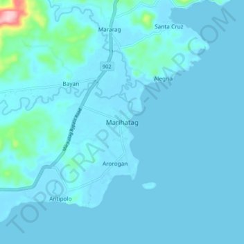
Name: Marihatag topographic map, elevation, terrain.

Location: Marihatag, Surigao del Sur, Caraga, 8306, Philippines (8.76056 126.25854 8.84056 126.33854)

Average elevation: 39 ft

Minimum elevation: -3 ft

Maximum elevation: 715 ft

Other topographic maps

Click on a map to view its topography, its elevation and its terrain.

Carrascal River

Philippines > Surigao del Sur > Carrascal

Average elevation: 463 ft

Hinatuan

Philippines > Surigao del Sur

Average elevation: 98 ft

Gear up for your next adventure:

🧭GPS Watch Accessories - Bands and chargers for GPS watches
🧭Orienteering Set - Complete compass and map reading kit
🪄Magnetic Compass - Accurate compass for navigation
🌐World Map Poster - Decorative world maps with topographic info
🔭Compact Binoculars - HD vision for scouting terrain and identifying distant landmarks

As an Amazon Associate, this site earns from qualifying purchases at no extra cost to you.