
Sams Creek topographic map
Interactive map
Click on the map to display elevation.
About this map
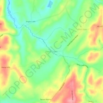
Name: Sams Creek topographic map, elevation, terrain.
Location: Sams Creek, Frederick County, Maryland, 21776, United States (39.47927 -77.13582 39.51927 -77.09582)
Average elevation: 620 ft
Minimum elevation: 469 ft
Maximum elevation: 810 ft