
Zlatar topographic map
Interactive map
Click on the map to display elevation.
About this map
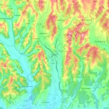
Name: Zlatar topographic map, elevation, terrain.
Location: Zlatar, Grad Zlatar, Krapina-Zagorje County, 49250, Croatia (46.05275 16.03734 46.13275 16.11734)
Average elevation: 686 ft
Minimum elevation: 499 ft
Maximum elevation: 994 ft