
En La Tannaz topographic map
Interactive map
Click on the map to display elevation.
About this map
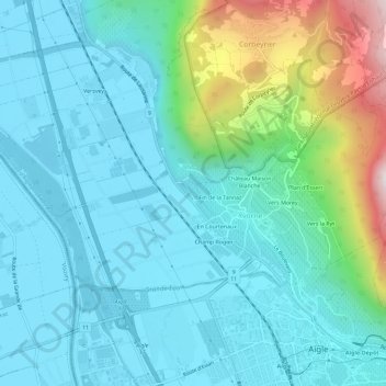
Name: En La Tannaz topographic map, elevation, terrain.
Location: En La Tannaz, Yvorne, District d'Aigle, Vaud, 1853, Suisse (46.31400 6.93015 46.35400 6.97015)
Average elevation: 1,775 ft
Minimum elevation: 1,217 ft
Maximum elevation: 4,085 ft
Other topographic maps
Click on a map to view its topography, its elevation and its terrain.
En Courtenaux
Suisse > Vaud > District d'Aigle > Yvorne
En Courtenaux, Yvorne, District d'Aigle, Vaud, 1853, Suisse
Average elevation: 1,795 ft