
Müggelheim topographic map
Interactive map
Click on the map to display elevation.
About this map
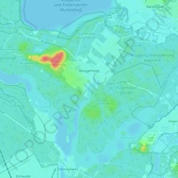
Name: Müggelheim topographic map, elevation, terrain.
Location: Müggelheim, Treptow-Köpenick, Karolinenhof, Berlin, Allemagne (52.38045 13.63092 52.43009 13.73903)
Average elevation: 125 ft
Minimum elevation: 98 ft
Maximum elevation: 344 ft