
Dover topographic map
Interactive map
Click on the map to display elevation.
About this map
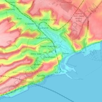
Name: Dover topographic map, elevation, terrain.
Average elevation: 187 ft
Minimum elevation: -3 ft
Maximum elevation: 446 ft
Other topographic maps
Click on a map to view its topography, its elevation and its terrain.
River
Royaume-Uni > Angleterre > Kent > Douvres
River, Douvres, Kent, Angleterre, Royaume-Uni
Average elevation: 262 ft