
Umguza topographic map
Interactive map
Click on the map to display elevation.
About this map
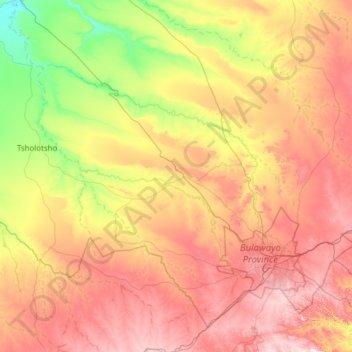
Name: Umguza topographic map, elevation, terrain.
Location: Umguza, Matabeleland North Province, Zimbabwe (-20.35534 27.75882 -19.36000 28.98388)
Average elevation: 3,996 ft
Minimum elevation: 3,245 ft
Maximum elevation: 5,013 ft
Other topographic maps
Click on a map to view its topography, its elevation and its terrain.
Turk Mine
Zimbabwe > Matabeleland North Province > Bubi
Turk Mine, Bubi, Matabeleland North Province, Zimbabwe
Average elevation: 4,255 ft
Cross Dete
Zimbabwe > Matabeleland North Province > Hwange
Cross Dete, Hwange, Matabeleland North Province, Zimbabwe
Average elevation: 3,346 ft
Hwange
Zimbabwe > Matabeleland North Province > Hwange
Hwange, Matabeleland North Province, Zimbabwe
Average elevation: 2,539 ft