
Cerro La Rosa topographic map
Interactive map
Click on the map to display elevation.
About this map
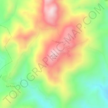
Name: Cerro La Rosa topographic map, elevation, terrain.
Location: Cerro La Rosa, Tamaca, Municipio Iribarren, Lara, Venezuela (10.22108 -69.35708 10.22118 -69.35698)
Average elevation: 3,051 ft
Minimum elevation: 2,402 ft
Maximum elevation: 3,678 ft