
Sovič topographic map
Interactive map
Click on the map to display elevation.
About this map
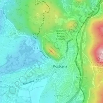
Name: Sovič topographic map, elevation, terrain.
Location: Sovič, Adelsberg, Küstenland-Innerkrain, 6230, Slowenien (45.77899 14.21071 45.77909 14.21081)
Average elevation: 1,893 ft
Minimum elevation: 1,686 ft
Maximum elevation: 2,454 ft
Other topographic maps
Click on a map to view its topography, its elevation and its terrain.