
Indian Springs topographic map
Interactive map
Click on the map to display elevation.
About this map
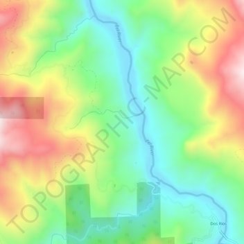
Name: Indian Springs topographic map, elevation, terrain.
Location: Indian Springs, Mendocino County, California, 95429, USA (39.71349 -123.39390 39.75349 -123.35390)
Average elevation: 1,670 ft
Minimum elevation: 817 ft
Maximum elevation: 2,966 ft
Other topographic maps
Click on a map to view its topography, its elevation and its terrain.
Indian Springs
USA > California > Indian Springs
Indian Springs, Madera County, California, USA
Average elevation: 623 ft