
足柄上郡 topographic map
Interactive map
Click on the map to display elevation.
About this map
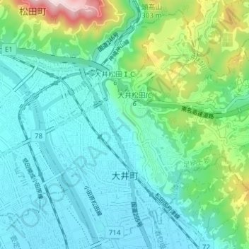
Name: 足柄上郡 topographic map, elevation, terrain.
Location: 大井町, 足柄上郡, Prefectura de Kanagawa, 関東地方, 258-0016, Japón (35.31333 139.13557 35.35935 139.19685)
Average elevation: 413 ft
Minimum elevation: 82 ft
Maximum elevation: 1,617 ft
Other topographic maps
Click on a map to view its topography, its elevation and its terrain.
江の島
Japón > Prefectura de Kanagawa > Fujisawa
江の島, Fujisawa, Prefectura de Kanagawa, 関東地方, 251-0036, Japón
Average elevation: 7 ft