Geolocate

Palacio topographic map

Click on the map to display elevation.

About this map
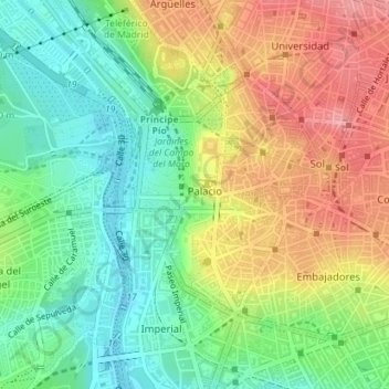
Name: Palacio topographic map, elevation, terrain.

Location: Palacio, Centro, Madrid, Community of Madrid, Spain (40.40669 -3.72291 40.42339 -3.70610)

Average elevation: 2,054 ft

Minimum elevation: 1,893 ft

Maximum elevation: 2,254 ft

Other topographic maps

Click on a map to view its topography, its elevation and its terrain.
Madrid

Spain > Community of Madrid > Madrid

Average elevation: 2,133 ft

Fuente de las Gaviotas

Spain > Community of Madrid > Madrid

Average elevation: 2,149 ft

Gear up for your next adventure:

👟Trail Running Shoes - Lightweight shoes for trail runners
📱Solar Portable Charger - Solar power bank for charging devices off‑grid
🌎3D Topographic Globes - Raised relief globes for a tactile understanding of geography
🍳Camping Cook Set - Complete cookware for outdoor meals
🪶Trail Camera - Capture wildlife on your hikes

As an Amazon Associate, this site earns from qualifying purchases at no extra cost to you.